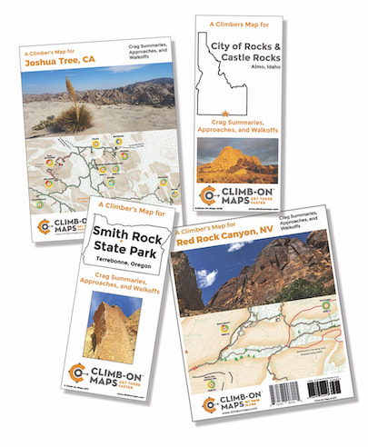
Climb-on Maps makes maps for rock climbing areas – Why did you decide to do this? Don’t guidebooks and other sources already have maps for these areas?
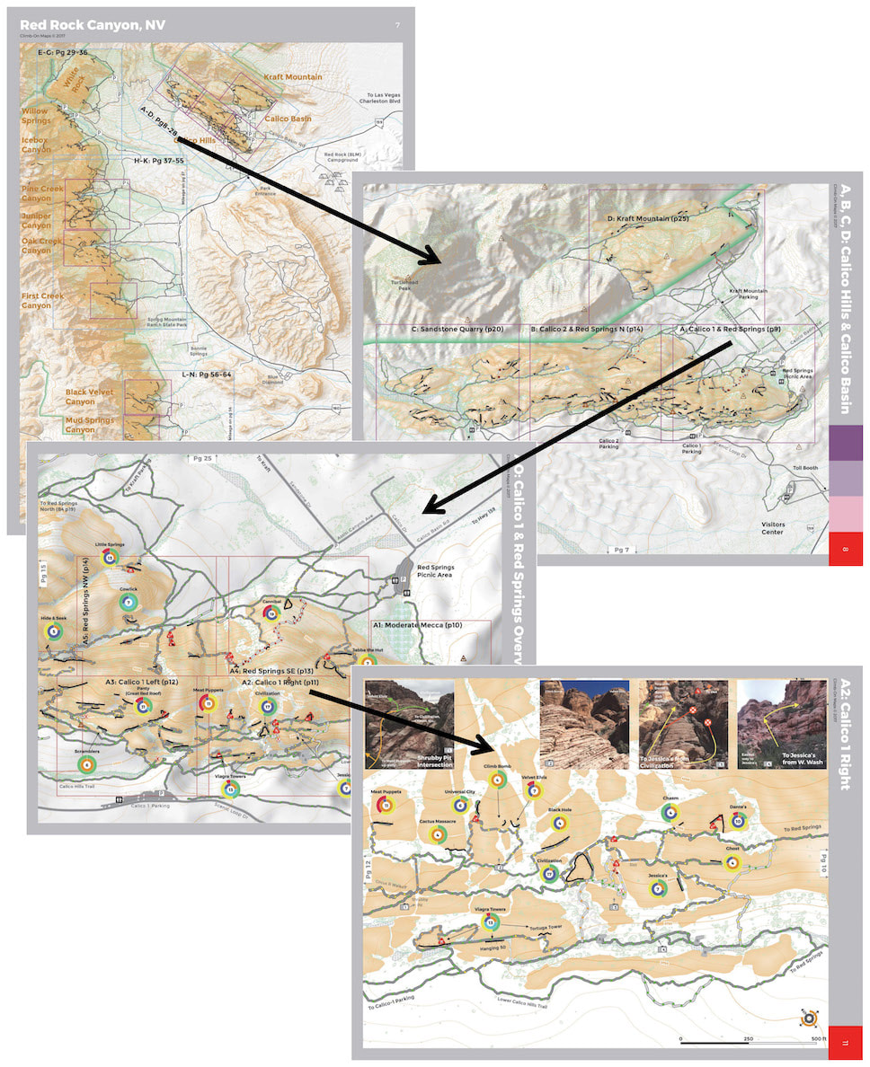
RICK: Well, technically yes, but using those sources just about everyone has gotten lost at least once trying to find a new crag. The main problem with those sources can be boiled down to “scale”. All publicly available data has been developed for a 1:24,000 scale which basically means that 1 inch on the map = 24,000 inches (2000 feet) on the ground. This really only gives you ballpark reference for features like streams, trails, etc. which doesn’t help much when navigating tricky terrain as climbers often do.
And the “Why” – I knew maps could be better. Having spent 20+ years in the mapping industry in roles from data collection and digitizing to analysis and programming, I know how important it is to have quality data. The only way to offer truly functional maps to climbers is to offer a high definition scale. Our map scales are between 1:1200 and 1:2400 which allows the map to show individual boulders and shrubs. This is critical when a 10 foot difference between two approach gully’s mean climbing as planned or adding an hour or more to your approach.
STEF: The why for me was I frankly got tired of getting lost instead of climbing. We’d take a long weekend or holiday from work, pay good money to go to someplace like Red Rock Canyon, NV, and then barely climb because we got lost. For a big multipitch if you arrive too late you risk an epic trying to walk-off in the dark, or if it’s a popular climb and you arrive too late you end up in line waiting. It happened too often and it frustrated me to no end! So, with me wanting to leave my old line of work in academia and Rick having the mapping background, I suggested this bonkers idea that we map large and confusing climbing areas.
|
Individual boulders and bushes – really? What else do you show on your maps?
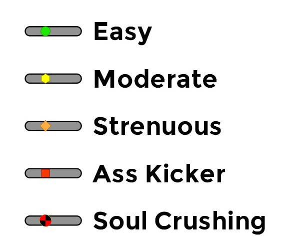
RICK : In addition to standard map features like roads and bathrooms, we also show big Pine trees, sign posts, gates, fences, and other reference items. We also pack in a lot of other information. Since we walked every trail on our maps, we display trails by difficulty from Easy to Soul Crushing. We identify points of exposure on the trail and rate those from Caution to Rest In Peace. We basically wanted to give the user as much information about what they will encounter as possible so they can make informed decisions about what they are “in for” when going to a particular wall. We also turbo-charged our crag labels so it not only shows the name, it also shows the distribution of grade difficulties and the distribution of types (trad, sport, and TR). So just at a glance you can tell if a crag has the type of climbing you want. STEF: Yes, and you can also easily see the access-relationship between crags (which is difficult to determine from guidebooks). For example, some walls are physically close to each other but they are bitch to go from one to the other. Conversely, you can have walls that seem inaccessible relative to each other, but if you know which boulder to crawl under and gully to go up, it’s pretty easy. It can help determine a cragging day, or if you show up to your planned wall and its super busy, you can pull out the map and quickly figure out where to go instead. |
How would you describe your philosophy as a small business?
RICK: We are really trying to do the “right thing” in every way. For us; for our customers; for Earth; for US economics; for land management.
We get our maps printed at a family run shop in Georgia (U.S.) because we don’t believe in sending work outside of our country, as well as the environmental costs of shipping (use of gasoline, polluting the oceans, and release of carbon dioxide). We get them printed on waterproof and tearproof paper so people will be able to use them for many years to come.
We pride ourselves on the quality of the data because we strive to produce a rock-solid map (yeah…sorry about that pun) that really helps the climber get to the crag faster and using a primary path. We have encountered a lot of braided trails and hope to direct users to the main trail to reduce the destructive impact on the land.
We have worked with land managers to identify sensitive and restoration areas and have redirected our trails to match their management plans. In Joshua Tree for example, we eliminated and remapped a bunch of trails when they shared their restoration plans with us.
|
|
What are some of the challenges and rewards you’ve experienced with Climb-on Maps?
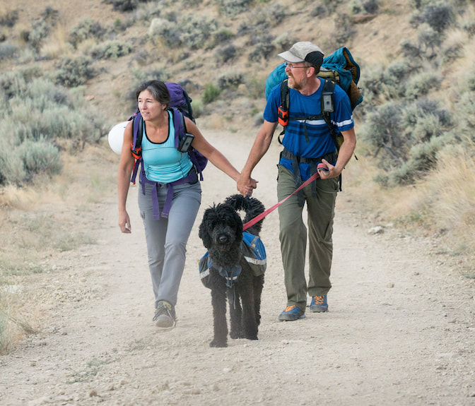
RICK: We’ve had a lot of both. Some of the rewards include having these beautiful areas being our “office”. Meeting great people who work for the parks, other small business owners, and other folks who we met along the way. STEF: Creating an extremely detailed, extremely functional, and beautiful map that helps the climbing community has been a reward. RICK But I’d say the best reward for me was spending so much time with Stefani and Althea (our standard poodle). Stef and I met later in life in our mid-40’s, and I feel this experience allowed us to make up for lost time. Living together, 24/7, in a crappy van that constantly broke down, and putting in 10+ grueling hours every day allowed us to really get to know each other fast. We learned how to resolve our differences quickly and kindly, because we were pretty much too freakin’ exhausted to fight. I wouldn’t recommend this relationship test for everyone, but I wouldn’t change our test for the world. We are much stronger now because of it. STEF: Awe shucks ;-). I do have to elaborate on that “crappy van” part because that was a real challenge! We sold our house and took our savings to start this business and we didn’t have the money to buy a nice newer vehicle. But we had some specific needs, like high clearance and 4-wd, to access some of the climbing walls. So we purchased a converted 1987 Chevy Astrovan, which needed a new everything (and I mean everything!). It broke down a lot and that sucked, especially living on the road (and, if we fought, it always seemed to be because of the van!). RICK: Ok, that’s true. The van made me blown my own gasket a few times… On the mapping front, one big challenge I had was realizing the time spent cleaning up the GPS data and creating the maps was roughly equivalent to the time spent out in the field collecting the data. It is a huge amount of work processing raw GPS data, and developing the other supporting data tables used to create the maps. |
STEF: I run the business side of things and we’ve had a lot of other challenges regarding a small business ownership. One challenge I'd like to forget happened was a counterfeiting battle we had with Amazon - arrggghh.
General business challenges include knocking on lots of doors and trying to gain visibility in the climbing world. To say that is a challenge is the understatement of the year. So many businesses will say how great our maps are and not buy anything. It’s really a catch-22; an unknown product is very hard to sell / product will remain unknown because it isn’t selling. It’s tough to hear nearly 100% positive feedback and still have a difficult time selling.
We are making progress though. After 2 years of promoting and selling, word of our maps is out there and sales are picking up. We hear from happy and grateful customers about their successful navigation and planning stories. We have also met a few businesses and visitor centers that are great people, enthusiastic supporters, and effective sellers of our maps (newsflash to businesses – our maps will sell if you point them out to customers buying guidebooks!! Haha)
What would you like to tell climbers about running a small business?
STEF: It is really hard work and a lot of it. I mean you have to have serious tenacity to not give up, and push forward with your vision. It’s one thing to have a great product, but it will NOT sell itself. Things often take longer and are more expensive than you expect, too. The financial stressors are very real.
RICK: More specific to our maps and guidebooks in general; An insane amount of time and energy goes into creating these products, and we create them because we want to help you, as a climber, have a more enjoyable climbing experience. We’ve met and talked with a lot of guidebook authors, and honestly, most guidebook authors simply have hopes to merely break even. Very few make a profit, and if they do, it’s quite small.
When you take pictures of our maps or of guidebooks, that is stealing. When you transfer information from a guidebook onto a public crowd sourced website, that is stealing. And, although it’s legal to do so, quite frankly renting a guidebook or map from a store, helps very few - none of that money goes back to the author or the publisher. Instead, when you buy a map or guidebook, it supports the store AND the publisher AND the guidebook/map author.
STEF: Another thing I loved for climbers to know is that shout outs mean a lot to a small business! We’re not asking you to peddle our products, but if you find our map cool, pretty, functional, etc., a shout out means a lot to us.
What are your goals for the future?
STEF: We definitely want to map some new areas and we have an exciting “to do” list. But, before tackling new areas, we needed to get our name out there, see how the climbing community received the maps, and recoup some of our out-of-pocket start-up expenses (printing the maps on waterproof tearproof paper is expensive!).
RICK: Regarding new areas to map, in the not-so-distant future we hope to really expand our map offerings to more climbing areas. Stef and I cannot physically map all the areas that we want to map, and we’re going to have to bring in help. However in order to maintain our commitment to absolute quality and perfectionism, we are going to have to build a partnership framework that covers everything from data collection to map production.
We’re really excited about future opportunities, but are also aware that our direction may change due to market influences, our needs and desires, changes in technology, and more.
Anything else you'd like people to know?
STEF: Rick and I are doing this fun and kinda-crazy thing we call the WTF 5.7 Tour: Red Rock Canyon, where we are climbing every single 5.7 in Red Rock Canyon - that's 237 climbs and over 50,000 vertical feet of 5th class climbing. We are tracking and posting about each of the climbs and giving it a WTF rating of some sort - like What the FUN! What the FEISTY! and, of course What the FUCK! For a climb to receive a What the FUCK rating it has to meet some very specific criteria. We post photos, videos, and stories about the climbing adventures (and there have been some adventures!) You can follow along on our social media and this webpage has our current status summary, links, and even a spreadsheet you can download with info about each of the climbs we've completed.
STEF: Rick and I are doing this fun and kinda-crazy thing we call the WTF 5.7 Tour: Red Rock Canyon, where we are climbing every single 5.7 in Red Rock Canyon - that's 237 climbs and over 50,000 vertical feet of 5th class climbing. We are tracking and posting about each of the climbs and giving it a WTF rating of some sort - like What the FUN! What the FEISTY! and, of course What the FUCK! For a climb to receive a What the FUCK rating it has to meet some very specific criteria. We post photos, videos, and stories about the climbing adventures (and there have been some adventures!) You can follow along on our social media and this webpage has our current status summary, links, and even a spreadsheet you can download with info about each of the climbs we've completed.
Get maps: https://www.climbonmaps.com/buy.html
Website: https://www.climbonmaps.com/
Instagram: @climbonmaps
Facebook: @climbonmaps
Website: https://www.climbonmaps.com/
Instagram: @climbonmaps
Facebook: @climbonmaps
*Common Climber does NOT take a percentage of sales when you follow a link to a business from our website, nor do we make money by featuring these businesses on the Common Climber Marketplace (other than if we offer a product in partnership with the business). We feature small businesses to help raise awareness and advance our climbing community.

