|
|
Introduction
|
Mont Blanc is the highest summit in Europe and home to the story of world mountaineering. Chamonix (France) and Courmayeur (Italy) are nearby towns.
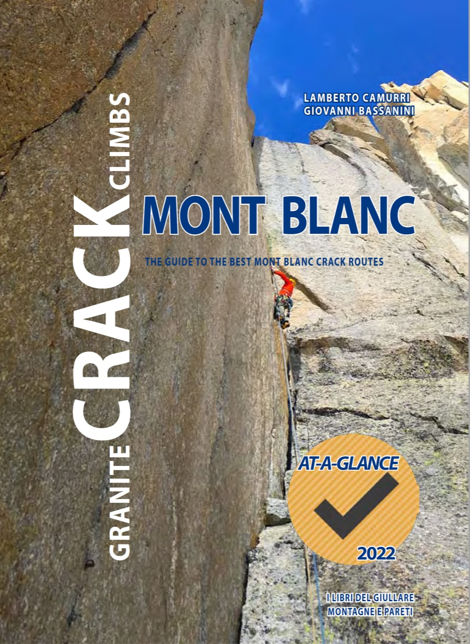
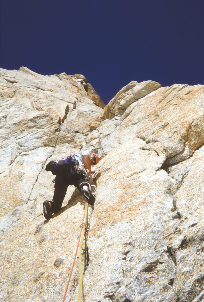
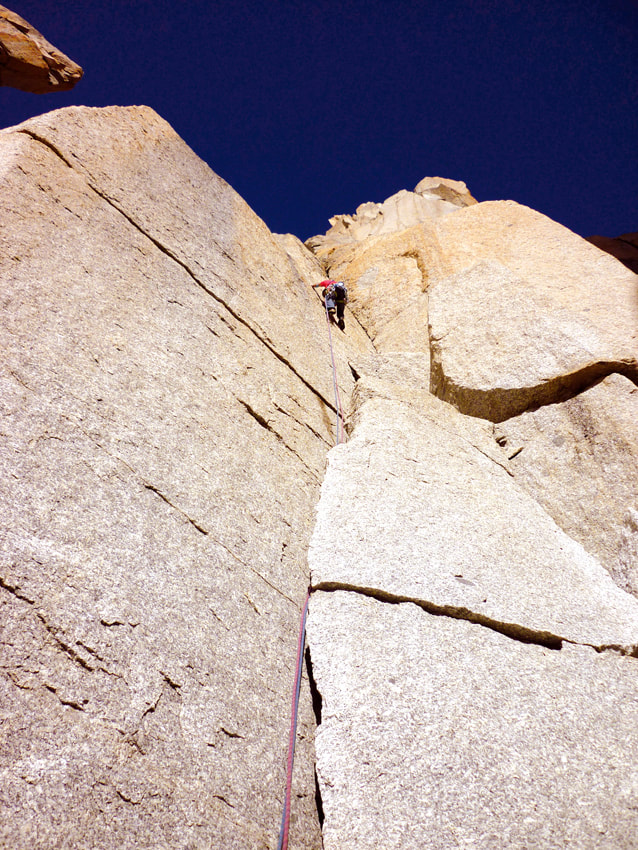
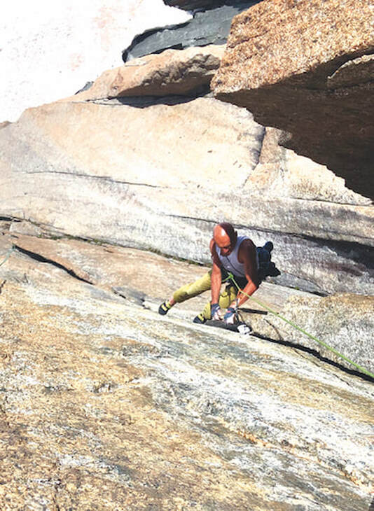
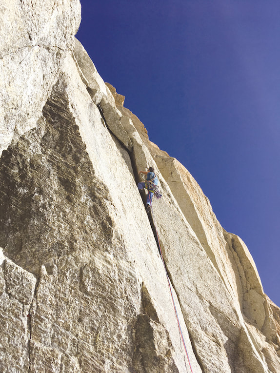
Mont Blanc is an iconic, varied mountain, a symbol born from its history, ice, rock, and the personalities who have climbed it. The great mountaineer and author Gino Buscaini, along with the editors of the Vallot guidebooks, have collected the sum of all the itineraries traced on this incredible mountain. Then, other climbers and writers followed, with their own stories, photos, and chosen itineraries - whether they were ice, mixed, or rock climbs. If Michel Piola has mastery of modern climbing on the granite of Mont Blanc and modern cracks had already been intuited by Gervasutti and Rébuffat, Romain Vogler was certainly the king of crack discovery. The new generations are now pressing on Vogler's experience, led by Dudas, Potard, and Dumas, who still demonstrate the inexhaustible reserve of Mont Blanc. Even then, each of these selective works has never been able to ignore the Vallot or Buscaini guidebooks. All who use the chosen itineraries must know the mountain through these fundamental books. This work - Granite Crack Climbs Mont Blanc (2022) is a guidebook that proposes a challenging task- extracting the "modern" cracks from the many rock routes on Mont Blanc. The book considers aesthetics, technique, and accessibility, and excludes crack lines in markedly glacial environments (approaches will still require crossing a glacier) or with objective risks like bad rock or ice falls. Safety is a central premise of this book and only includes routes that have fixed belays, allowing descent from the route if needed. The aesthetics we considered when choosing a route to include in this book are beautiful, clean lines that protect well and can be climbed clean. There are a few exceptions that have some fixed gear and slab, but they were chosen for the overall quality of the route and/or its superb location. Despite the altitude, by considering these important factors along with the weather, finding the right climbs can allow you to climb the Mont Blanc granite no differently than the Yosemite Valley. Granite Crack Climbs Mont Blanc by Lamberto Camurri and Giovanni Bassanini. is the guide book to the best crack routes of the Mont Blanc. The routes are described by text, photo and topo in Yosemite style. Area BasicsEQUIPMENT
All the climbs are in a high mountain environment between 2500 and 4200 meters (8200 - 13,700 feet) above sea level. Bring clothing for high altitude conditions that can change quickly, with high winds, rain, and snow. Boots, ice axe, crampons are needed on all the climbs where the approach is on a glacier, in addition to the minimum self-rescue equipment. Depending on the time of year, when there are scarce snow conditions, it is advisable to choose light glacier equipment, to make the trip less tiring. All the routes described, unless otherwise indicated, can be climbed with two 50m ropes. A large supply of cams, carabiners, slings, and quickdraws are required. Unless otherwise indicated, the routes have fixed anchors. HOW TO GET THERE
The Mont Blanc massif has three sides: Italian, French, Swiss. From Italy, the reference points are:
|
|
Chamonix is the starting point on the French side.
Lastly, the Swiss side has an access point to Lake Champex which can be reached from Martigny or from the Gran San Bernardo Pass, and the Cabanne d'Orny.
- The base for the Téléphérique de l'Aiguille du Midi, and for the Montenvers train
- The Refuge de l'Envers des Aiguilles
- The Refuge de la Charpoua
- The Refuge du Couvercle
Lastly, the Swiss side has an access point to Lake Champex which can be reached from Martigny or from the Gran San Bernardo Pass, and the Cabanne d'Orny.
RATINGS
Defining the difficulty is not easy, especially on granite and in the high mountains. Grades were initially given in the early ascents of Mont Blanc, and there was a lot of variability over the years. Recently, some sandbagging (labeling a climb with a lower/easier grade than what it really is) has also developed. In Granite Crack Climbs Mont Blanc we have tried to define the difficulties rigorously, so that they are comparable to each other, also bringing them to a contemporary level. However, crack climbing is subjective and the diffculty often varies per individual (e.g. size of fingers, hands, or fists). For each climb we describe the crack size, not only for protection but also to help to predict the width of the slot for the joint. You can calibrate your own measurements, approximately the proximal joint of the index or middle finger is 2 inches or 5 cm, the middle joint is 1.5 inches or 3 cm, the distal joint is 1 inch or 2.5 cm. (1 inch = 2.54cm). Difficulty ratings are presented in French scale.
Defining the difficulty is not easy, especially on granite and in the high mountains. Grades were initially given in the early ascents of Mont Blanc, and there was a lot of variability over the years. Recently, some sandbagging (labeling a climb with a lower/easier grade than what it really is) has also developed. In Granite Crack Climbs Mont Blanc we have tried to define the difficulties rigorously, so that they are comparable to each other, also bringing them to a contemporary level. However, crack climbing is subjective and the diffculty often varies per individual (e.g. size of fingers, hands, or fists). For each climb we describe the crack size, not only for protection but also to help to predict the width of the slot for the joint. You can calibrate your own measurements, approximately the proximal joint of the index or middle finger is 2 inches or 5 cm, the middle joint is 1.5 inches or 3 cm, the distal joint is 1 inch or 2.5 cm. (1 inch = 2.54cm). Difficulty ratings are presented in French scale.
GEAR
Each climb description presents the size of the protection needed along the pitch. Measurements are represented in inches and aligned with the numbers of two main brands (Black Diamond and Fixe Aliens). An adequate supply of cams, passive protection (nuts/stoppers), quickdraws, carabiners, and slings is always needed.
Each climb description presents the size of the protection needed along the pitch. Measurements are represented in inches and aligned with the numbers of two main brands (Black Diamond and Fixe Aliens). An adequate supply of cams, passive protection (nuts/stoppers), quickdraws, carabiners, and slings is always needed.
|
|
Summaries of the Areas & Featured Climbs
COMBE MAUDITE. TOUR RONDE RIDGE TO THE MONT MAUDIT
From Courmayeur, the SkyWay Mont Blanc goes up to Punta Helbronner to overlook the French slope. The southeast ridge at Mont Maudit starts from the Aiguille d'Entréves passing over the Tour Ronde then, along the Crest Kuffner, joins Pointe de L'Androsace, over the Combe Maudite.
This area has routes mainly of mixed ice, however the east faces of Tour Ronde and Pointe de l'Androsace have two important granite shields.
Access: From Punta Helbronner or Rifugio Torino follow the glacier track keeping to the left under the Aiguille du Toula and aiming first at the base of the Tour Ronde then continuing without losing altitude towards the other walls. The east face of the Tour Ronde can be reached from the track of the normal route, while to reach the Pointe de l'Androsace aim for the center of the Combe Maudite slightly uphill right up to the face.
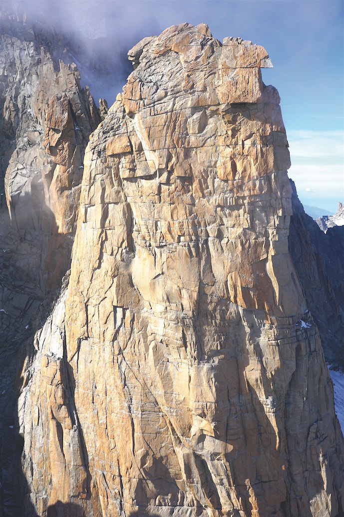
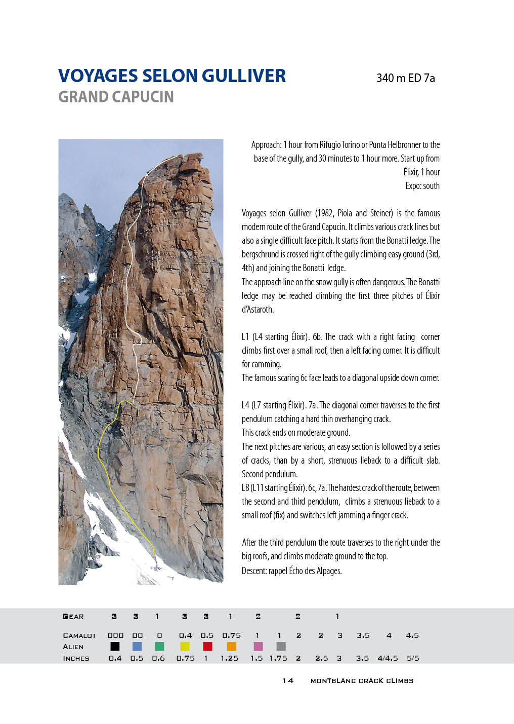
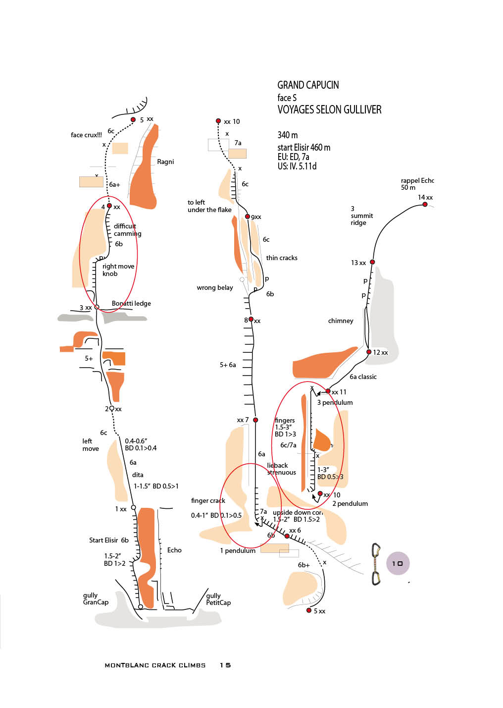
Above: Excerpts from the book Granite Crack Climbs Monte Blanc for Grand Capucin. Voyages selon Gulliver.
MONT BLANC DU TACUL, COMBE MAUDITE, GRAND CAPUCIN
Grand Capucin is the the crown of spires that surround the summit of Mont Blanc du Tacul. Mont Blanc du Tacul is a prominent symbol of granite climbing because of its visibility, shape with the summit hood, 400-meter (1300-foot) walls. Even its easy accessibility puts it in first place with a symbolic twinning to the Californian El Capitan.
Its Mont Blanc du Tacul's modern history began with the route traced by Walter Bonatti in 1951 in the center of the east face. An almost completely aided route using blade pitons and wooden wedges, Bonatti dared to slip between the roofs.
The Swiss Route on the southwest face of the Grand Capucin was climbed in 1956. And, the Lecco Route and the East Corner followed. After these ascents, the story of Capucin seemed to stop - so much so that even Gianpiero Motti, an inspired mountaineering historian, affirmed that the "games were over." This was a short-sighted forecast. So much so that in the early 1980s a group of Swiss and French climbers (Michel Piola, Romain Vogler, Jean Marc Boivin together with their brigades) arrived to weaved a web of routes up Grand Capucin, competing with each other for difficulty and beauty.
The face was so completed it left room for only a few extreme routes, often fractions of existing routes such as the Trésor de Romain, in honor of Romain Vogler, master of the cracks in this granite.
Access: From Punta Helbronner pass the Grand Flambeau, gently descending the glacier at the base of the Aiguille d'Entreves and the Tour Ronde to continue on the flat directly under the wall.
Routes Featured in the Book
Grand Capucin. Swiss route, O Sole Mio
Grand Capucin. Voyages selon Gulliver
Grand Capucin. Elixir d’Astaroth
Grand Capucin. Le Trésor de Romain
Grand Capucin. Echo des Alpages
Grand Capucin. Bonatti
Grand Capucin. Haute Tension
|
|
|
MONT BLANC DU TACUL, COMBE MAUDITE, THE MINOR SATELLITES
The minor satellites of Mont Blanc du Tacul surround its summit and flank the Grand Capucin in a corollary of red granite walls. In their structure, crack lines prevail. Access: From Italy take the Mont Blanc SkyWay up to Punta Helbronner or the Rifugio Torino. From France take the Téléphérique de l'Aiguille du Midi. Except for Pointe Lachenal, the approach is shorter from Italy. The Satellites overlook the Combe Maudite, the Vallée Blanche, and the Giant Glacier. At the head of Cirque Maudit the first wall is the Clocher du Tacul on which the red triangle of the pillar stands out. Then, go down, the Chandelle, which is separated from the Trident by the gully, which gives access to the Petit Clocher. The Trident is the cornerstone and the slope changes from southwest to south. and, After the two Capucins, appears the Pic Adolphe Rey and the Pyramide du Tacul. Finally, the Pilier Tres Pointes, high up next to the Gervasutti pillar and the Pointe Lachenal, surround the east side of Mont Blanc du Tacul. The approach to Clocher, Chandelle, Trident and Pic Adolphe Rey (except for the Bettembourg Route) starts from Punta Helbronner or Rifugio Torino. The Grand Flambeau descends gently to the glacier at the base of the Aiguille d'Entreves and the Tour Ronde. Continue along the floor directly under the circus of the walls. The approach to the Bettembourg Route of Pic Adolphe, Pyramide, Pilier Tres Pointes and Pointe Lachenal goes down the track of the the Vallée Blanche traverse to the walls. Pointe Lachenal can also be reached from the Aiguille du Midi. |
|
Routes Featured in the Book
Clocher du Tacul. Fissurissime Clocher du Tacul. Yosemite Ethics Clocher du Tacul. Profiterole Clocher du Tacul. Empire State Building Clocher du Tacul. Kousmine Clocher du Tacul. Ivresse des Latitudes Clocher du Tacul. Boivin route Clocher du Tacul. Pifferaio di Spit Clocher du Tacul. Gran Torino Clocher du Tacul. Conflitto Finale Chandelle du Tacul. Bonatti Tabou Chandelle du Tacul. Ligne Blanche Chandelle du Tacul. Lanfranconi Cosson - Phoenix Trident du Tacul. The West is the Best Trident du Tacul. Astro Zap Trident du Tacul. Les Intouchables Trident du Tacul. Le Peau et les Os – Braille Crack |
Petit Clocher du Tacul. Tunnel Surprise
Petit Clocher du Tacul. Bridwell Crack Pic Adolphe Rey. NW Face Direct Pic Adolphe Rey. Notte di San Silvestro Pic Adolphe Rey. Police des Glacier Pic Adolphe Rey. Charles Bronson Memory Pic Adolphe Rey. Gervasutti Pic Adolphe Rey. Coup de Foudre Pic Adolphe Rey. Bettembourg Pic Adolphe Rey. Cache Cache Pic Adolphe Rey. Fil au Face Pyramide du Tacul. Taxi Surprise Pilier Trois Pointes. Totem Pointe Lachenal. Contamine Pointe Lachenal. Or Or Pointe Lachenal. Le Macroscope Pointe Lachenal, Californie. Consequence Photos Pointe Lachenal, Californie. Haut et Court |
|
|
AIGUILLES DE CHAMONIX. AIGUILLE DU MIDI. PLAN DES AIGUILLES
The Téléphérique de l'Aiguille du Midi (3842 m) is the starting point to reach the southeast face of the Midi. It is also the access, at the end of the first section, to the Plan des Aiguilles, for the western slopes of the other Aiguilles de Chamonix, Peigne, and Blaitière, in particular. From the summit station of the Midi, the access to the south wall is simple, following the trail of the Vallée Blanche to the base of the wall.
Aiguille du Midi. From the summit station of Midi, the access to the south face is easy, following the trail of Vallée Blanche until you are beneath the wall. An alternative approach is to abseil the routes beside the balcony of the summit station.
Routes Featured in the Book
Aiguille du Midi. Midi Melodie
Aiguille du Midi. Le Fou de l’Aiguille
Aiguille du Midi. Ma Dalton
Aiguille du Midi. Rébuffat
Aiguille du Midi. Contamine
Aiguille du Midi. Super Dupont
Aiguille du Midi. Mr.De Mesmaeker
|
The Aiguille du Peigne (3192 m) stands out in front of the Plan station. Its western wall faces the Glacier des Pélerins. From the station the path runs along the edge of the glacier towards the Arête des Papillons with small slope. In view of the west face of the Peigne the track becomes steep before the last stretch of glacier, short and without crevasses. The summit of the Peigne can be reached from the north side, with a combination of one of the slabs on the lower part of the face and the Rébuffat Route on the summit shield. From the Plan des Aiguilles station, the path runs along the grassy slopes pointing to the left of the Arête des Papillons. The track leads to the base of the large gray wall and its routes
Routes Featured in the Book Aiguille du Peigne. Peigne Perdu Aiguille du Peigne. Postscriptome Aiguille du Peigne. Fermeture Eclair Aiguille du Peigne. Rébuffat Looking from the valley, the Aiguille de Blaitière (3522 meters) appears to the left of the Peigne, beyond the half-hidden Aiguille du Plan. From the Plan station, the path turns left passing under the moraine of Lac Bleu and maintains its altitude passing on the front of the Glacier de Blaitière. The track goes up the moraine and moves to the left at an altitude 2500 meters on the glacier border that rises to the base of Pilier Rouge. The exposed saddle surrounds the corner to the western slope and the walls above the Glacier de Blaitière. Routes Featured in the Book Aiguille de Blaitière. Brown Aiguille de Blaitière. Fidel Fiasco Aiguille de Blaitière. Draculacescu Aiguille de Blaitière. Destroy Aiguille de Blaitière. Pilier Rouge. Echec et Marx Aiguille de Blaitière. Pilier Rouge. Bobokassa Aiguille de Blaitière. Pilier Rouge. Majorette Tatcher Aiguille de Blaitière. Pilier Rouge. Tripoli Aiguille de Blaitière. Pilier Rouge. Les Deux Goals |
AIGUILLES DE CHAMONIX. L’ENVERS DES AIGUILLES
The Envers des Aiguilles includes the eastern slope of the Aiguilles of Chamonix overlooking the Mer de Glace. The Refuge de l’Envers can be reached from the Montenvers railway station. Steep iron stairs lead on the Mer de Glace glacier then the walk keeps the orographic left side until the exit on the moraine (represented by a large yellow mark in the figure in the book) to climb more stairs up to the path halfway up the slope which goes up to the refuge (3 hours). The route on the glacier varies with the seasons. Around the refuge there are numerous rock routes, the orography, and the inclination of the walls often favor slab structures. However, there is no shortage of class cracks.
The Envers des Aiguilles includes the eastern slope of the Aiguilles of Chamonix overlooking the Mer de Glace. The Refuge de l’Envers can be reached from the Montenvers railway station. Steep iron stairs lead on the Mer de Glace glacier then the walk keeps the orographic left side until the exit on the moraine (represented by a large yellow mark in the figure in the book) to climb more stairs up to the path halfway up the slope which goes up to the refuge (3 hours). The route on the glacier varies with the seasons. Around the refuge there are numerous rock routes, the orography, and the inclination of the walls often favor slab structures. However, there is no shortage of class cracks.
|
Routes Featured in the Book
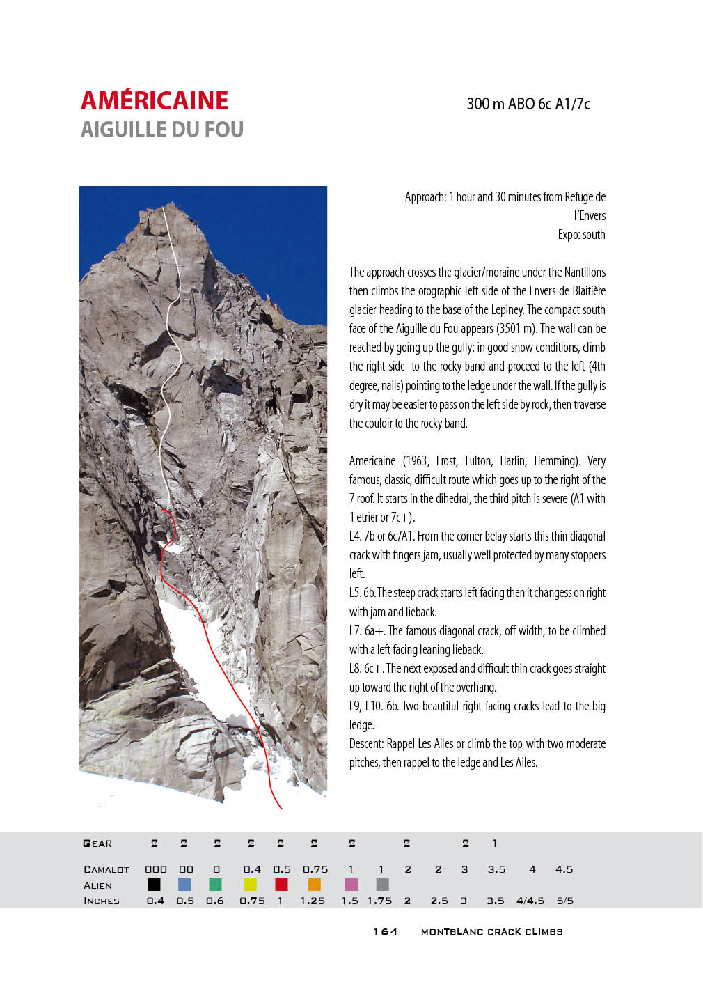
Tour Verte. La Piége Tour Rouge. Le Marchant de Sable Tour Verte. Retour à la Montagne 3 éme Pointe Nantillons. L’Homme du Rio Grande Aiguille de Roc. Tout va Mal Aiguille de Roc. Pedro Polar Aiguille du Fou. Américaine Aiguille du Fou. Les Ailes du Désir Aiguille Pierre-Alain. Clin d’oeil AIGUILLES DE CHAMONIX. MER DE GLACE RIGHT SIDE
The right bank of the Mer de Glace is dominated by one of the most famous and represented spires of the Mont Blanc: the Aiguilles du Dru, formed by two summits, the Grand Dru (3754m) and the Petit Dru (3733m). The latter, with its west face, was one of the most important climbing targets in the world, with the Magnone Route and the Bonatti Pillar, the two American Routes from the 1960s and numerous other achievements. In recent years however, the Mont Blanc massif has seen frequent grandiose collapses. Since the torrid summer of 2003, important collapses have hit the Walker Spur at the Grandes Jorasses, and have obscured the star of American Beauty at the Rognon du Plan, but above all they have broken the west face of the Petit Dru. Periodic landslides with enormous quantities of rock have made climbing the whole face inadvisable. For this reason the routes on the west face of the Petit Dru are not presented. The buttress of the Flammes de Pierre leans against the Drus, whose southern walls overlook the Charpoua glacier. The Aiguille du Moine (3412 meters) stands on the right edge of the Mer de Glace with its West Pillar. The Refuge de la Charpoua is located at the top of the central moraine of the glacier and is the starting point for climbing the walls of the Flammes de Pierre and the Pillar du Moine. It faces southwest and receives the sun's rays until sunset. Its location offers the widest view of the Mont Blanc massif. |
The Refuge de la Charpoua can be reached from the Montenvers railway station. Steep iron stairs lead on the Mer de Glace then the track crosses the glacier and follows its border. An easy climbing route goes up the lateral bank until the path that continues halfway up the grassy slopes and goes around the Flammes de Pierre. The track crosses the granite slabs under the glacier front then climbs steeply up to the refuge (2.30 hours).
Routes Featured in the Book
Flammes de Pierre. La Reprise
Flammes de Pierre. Elan Vertical
Aiguille du Moine. Pilier Ovest. Sale Athée
The Aiguille du Moine has a beautiful east face on the Talèfre glacier. The Refuge du Couvercle (2687 meters) is mainly frequented to climb the Aiguille Verte. It rises near the Pierre du Couvercle, an enormous monolith, facing south just above the seracs of Talèfre. It faces the north face of the Jorasses, which is very close and dramatically changes color every minute with the turning of the sun. From inside the dining room of what?, one window overlooks the Walker Spur, the border chain until the Dent du Geant and, alongside, the Mont Blanc du Tacul and its satellites.
The Refuge du Couvercle can be reached from the Montenvers railway station. Steep iron stairs lead on the Mer de Glace, the walk along it tends to its orographic right side and is marked by colored bins. At the junction between the Leschaux glacier and the Mer de Glace, a steep stairway leads up to the Tête du Couvercle then to the refuge (3 hours).
Routes Featured in the Book
Aiguille du Moine. Miss Tique
Routes Featured in the Book
Flammes de Pierre. La Reprise
Flammes de Pierre. Elan Vertical
Aiguille du Moine. Pilier Ovest. Sale Athée
The Aiguille du Moine has a beautiful east face on the Talèfre glacier. The Refuge du Couvercle (2687 meters) is mainly frequented to climb the Aiguille Verte. It rises near the Pierre du Couvercle, an enormous monolith, facing south just above the seracs of Talèfre. It faces the north face of the Jorasses, which is very close and dramatically changes color every minute with the turning of the sun. From inside the dining room of what?, one window overlooks the Walker Spur, the border chain until the Dent du Geant and, alongside, the Mont Blanc du Tacul and its satellites.
The Refuge du Couvercle can be reached from the Montenvers railway station. Steep iron stairs lead on the Mer de Glace, the walk along it tends to its orographic right side and is marked by colored bins. At the junction between the Leschaux glacier and the Mer de Glace, a steep stairway leads up to the Tête du Couvercle then to the refuge (3 hours).
Routes Featured in the Book
Aiguille du Moine. Miss Tique
|
AIGUILLES DE CHAMONIX. AIGUILLE DE L’ARGENTIERE
The Argentière valley is crossed by its long glacier and by the Gands Montets glacier. It is probably the most famous glacial basin on Mont Blanc due to the series of big north faces that enclose its left side: Les Courtes, Les Droites, La Verte. In addition to being the balcony on the north, the right side offers mountains of undoubted importance dotted with some splendid monoliths of fissured red granite. La Vierge dell'Aiguille d'Argentière is the most significant, a small Capucin in the middle of the Milieu glacier. The walls are exposed to the south and in favorable seasons they can be climbed in spring. As of this writing (September 2023), the Télépheérique from Argentière to the Grands Montets station at 3300 metres is closed. The approach uses an alternative lift facility followed by a new track leading to the glacier. Routes Featured in the Book Aiguille d’Argentière. La Vierge. Reve de Singe Aiguille d’Argentière. La Vierge. Ciao Vinc Aiguille d’Argentière. Le Minaret. Versant Satanique MONT BLANC SUISSE. GLACIER D’ORNY
The Arve valley rises from Chamonix towards Argentière and Switzerland. The Swiss side of Mont Blanc is not particularly relevant for rock faces, with the exception of the far east. Access: From Martigny, the main road to Gran San Bernardo leads to the crossing point for Champex which can be reached along a beautiful road in the woods. Champex has the lake and a residential area. |
From Italy Champex can be reached from Aosta and Gran San Bernardo tunnel. The Breya chairlift goes up to 2200 meters, then the path overlooking the Combe d'Orny starts. In two hours of pleasant walking, the path reaches the Col de la Breya, the Orny glacier basin ,and arrives at the Cabane d'Orny (2811 meters).
The Petit Clocher du Portalet (2823 meters), with its splendid north face, appears when walking to the Cabane d'Orny.
Routes Featured in the Book
Petit Clocher du Portalet. État de Choc
Petit Clocher du Portalet. Ave Caesar
Petit Clocher du Portalet. Esprit de Clocher
The Petit Clocher du Portalet (2823 meters), with its splendid north face, appears when walking to the Cabane d'Orny.
Routes Featured in the Book
Petit Clocher du Portalet. État de Choc
Petit Clocher du Portalet. Ave Caesar
Petit Clocher du Portalet. Esprit de Clocher
|
|
|
VAL FERRET. MONT ROUGES DE TRIOLET
The Monts Rouges de Triolet are the chain of peaks to the left side of the Triolet glacier. They can be reached from the Italian Val Ferret. Access: From Courmayeur the Val Ferret road reaches Planpincieux and continues to the end of the valley. After about a kilometer of dirt road, facing the entrance to the Triolet valley, the path crosses the Dora di Ferret and goes up the left moraine with a slight slope. After passing the Parete dei Titani, the path arrives under the glacial front, then leaves the moraine edge and climbs steeply up the side by path and fixed ropes up to the Dalmazzi Hut (1 hour and 30 minutes). There are many spires along the immense ridge to the Aiguille de Triolet. The first important peak is the Seconda Punta Centrale (3289 meters). The Northern Point (3432 meters) of the Monts Rouges de Triolet is the main relief encountered following the ridge. Routes Featured in the Book Monts Rouges de Triolet. Profumo Proibito Monts Rouges de Triolet. Cristallina Monts Rouges de Triolet. Tout Fou Monts Rouges de Triolet. Le Fond de l’Air Monts Rouges de Triolet. Reglettes da Ballo VAL FERRET. TOUR DE JORASSES AND DENT DU GEANT
The Planpincieux glacier and the Grandes Jorasses glacier overlook the Val Ferret of Courmayeur and lead to the normal route of the Grandes Jorasses. Wedged between these two glaciers, below the Rognon della Bottiglia, stands the Rifugio Boccalatte (2804 meters). The upper part of the glacier touches the western slope of the Tour de Jorasses (3813 meters). |
Access: From Courmayeur the Val Ferret the road reaches Planpincieux. The path to the Rifugio Boccalatte starts behind the church, climbs to the orographic left side of the moraine (look for paint marks) until it overlooks the Grandes Jorasses glacier, and reaches the hut (2-3 hours). This hut is usually unattended.
Dent du Géant (4013 meters) is one of the most famous and represented pinnacles of Mont Blanc. Its normal route has always been equipped with a cable and is a popular destination for climbers of all ages. The south face overlooks the Val Ferret. From the Rifugio Torino, the track crosses the glacier under the Aiguilles Marbrées and reaches the base of the Dent du Geant. The rocks at the left of the couloir lead along an inconspicuous trail to the ridge and the saddle, the so-called Gingiva, the base of the wall.
Routes Featured in the Book
Tour de Jorasses. Etoiles Filantes
Dente del Gigante. Dent du Géant. Burgasser
About the Author: Lamberto Camurri
|
Lamberto Camurri was born in 1951 and is an alpinist, rock climber, biologist, and naturalist. He has a PhD in medical genetics and applied genetics and is the Technical and Scientific Director (PhD, ASHG, ESHG, SIGU) of a medical genetics facilities in Italy, as well as a fellow scientist Institute of Medical Genetics Torvergata University Rome.
Lamberto has published 102 international scientific contributions and has numerous climbing publications including:
CONTACT: Lamberto Camurri [email protected] Trattamento dati sensibili GDPR 679/2016 http://www.camurrilamberto.it/genetist/fondo-genetist.html |


